The Wood County Emergency Management Agency has issued the following advisory:
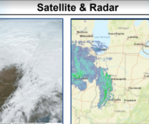
Remnants of Beryl will pass through Wood County tonight and tomorrow.The heaviest rain now appears to be to the north and west of Wood County. However, this system has a history of tornadoes that cannot be ruled out during the nighttime hours tonight. As the front passes through, wind gusts 30-35 mph are possible, increasing to 35-45 mph on Wednesday with showers expected to be patchy throughout the day.

Everyone should keep their cell phones charged and loud enough to wake them should there be a significant severe weather.
Additionally, the current heat dome that has been over the western states is expected to be over Ohio early next week.