The Wood County Emergency Management Agency has issued the following advisory:
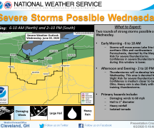
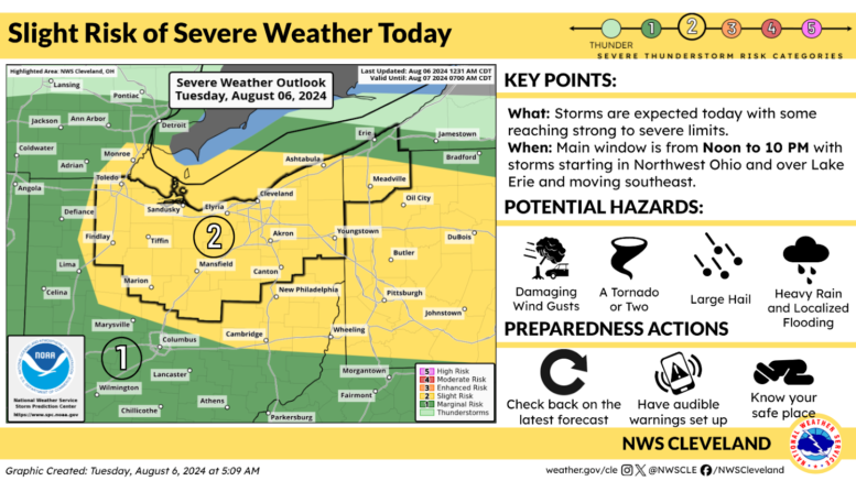
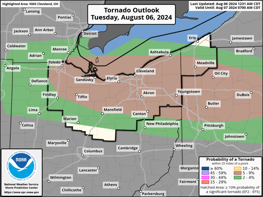
Wood County is under a “Slight” (2 of 5) for severe weather today placing us under a tornado watch until 3 p.m.
A few passing showers are possible before noon as the cold front pushes across the county with a risk of thunderstorms between 1-3pm. Some storms could be strong to severe with the main threats of hail (0.5-1.5”), wind gusts in excess of 50 mph, 1-2” of rain and tornado activity possible. As this front passes, there will be an isolated chance of showers or storms for the remainder of the day and evening with dry conditions overnight.
Make sure you have multiple ways to receive emergency warnings in the event the National Weather Service issues them.
What to expect:
- Good coverage of showers and thunderstorms is expected this afternoon and evening across the area.
- Storms will have the potential to reach severe limits with all hazards possible including damaging wind gusts, a tornado or two, large hail, and heavy rainfall that could lead to isolated flooding.
- The main window for activity is from Noon to 10 PM with storms moving into Northwest Ohio and over Lake Erie and moving southeast.
The following links can be bookmarked for the latest information:
Updates from the Storm Prediction Center can be found at www.spc.noaa.gov/
As storms develop, Local Storm Reports can be found here.
The latest forecast for your location can be found by clicking on the map at www.weather.gov/cle.
Click here for our quick brief webpage, which includes the latest briefing slides.
National Weather Service Cleveland