By JAN LARSON McLAUGHLIN
BG Independent News
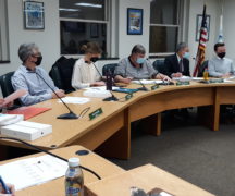
Bowling Green City Council peddled some changes to the city’s updated bicycle plan Tuesday evening – including the study of bike provisions on Main Street from Newton to Napoleon roads.
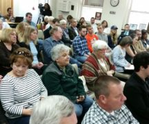
The bicycle plan, approved by the city’s planning commission in November, had suggested that a bike bypass be designed around the downtown. But during a public hearing on the plan Tuesday evening, council members voiced other opinions.
“The city needs to consider a combination of protected bicycle lanes,” the length of Main Street, said council member Rachel Phipps.
Rather than relegating bikes to side streets, council member Nick Rubando and Phipps pushed for accommodation for bikes on Main Street in the downtown and beyond.
Their recommendation was backed up by the chairman of the city’s Bicycle Safety Commission, Stephen Langendorfer, who echoed the need for a protected bike lane or shared use path on Main Street.
The city is already planning a shared use path along South Main Street between Napoleon and Gypsy Lane roads.
Council member Bill Herald also backed the idea of studying the options.
“To give us an idea of what’s possible, what’s not possible,” Herald said.
Langendorfer also asked that similar accommodations be studied for West Wooster Street, from downtown to Haskins Road.
City Council adopted the updated bike plan with an amendment to add dotted pink lines the length of Main Street and on a portion of Weston Wooster – indicating that options are being examined.
“We’re not forcing anyone to build a bike lane down Main Street,” Rubando said. “We are looking into all options.”
Council member Joel O’Dorisio agreed with the amendment, noting that a study showed the most dangerous places for bike accidents are on Main Street.
Council member Jeff Dennis suggested another amendment, that bike “sharrows” be removed from the map legend as an accommodation for bicyclists. Dennis said the signs throughout the city stating “bikes may use full lane” are more effective and less expensive.
The sharrow decals on streets cost about $500 each and must be reapplied every 500 feet – making them very expensive.
Herald added that the sharrows do not hold up well during winter weather.
But others preferred to leave sharrows on the list of possible accommodations.
The updated Bicycle Facilities and Destinations Map in the Transportation Section of the city’s Comprehensive Plan was created based on a bicycling study by Mannik & Smith.
Public Services Director Joe Fawcett had explained to Planning Commission members that the city’s current plan for bicycles lacks specificity and does not reflect current bicycling trends.
The new study found that road diets, a downtown bike bypass, and more use of pedestrian beacons could help motorists and bicyclists better share roadways in Bowling Green.
A road diet in Bowling Green could make bicyclists more comfortable riding on some city streets. Many city streets have 12-foot wide lanes, but ODOT allows 10-foot lanes – which leaves four feet for a bike lane.
The plan comes with a map of bicycling accommodations already in place, those currently underway, those in the planning process, and those further down the road.
Included in the plan are:
- Potential shared road corridors (shown in magenta), which could use a mix of sharrows, signs or on-street bike lanes.
- Future planned shared use paths (in green), which include the project planned on South Main Street from Napoleon to Gypsy Lane, and from the high school to the community center and Cogan’s Crossing development.
- Potential shared use paths (in blue) shown on Haskins Road, Newton Road, North College Drive, East Poe Road, Mercer Road, East Wooster Street, and South Dunbridge Road.
- Downtown bicycle bypass route (in yellow) on Prospect Street and Church Street.
- Existing shared use paths (in orange) including the section of East Wooster Street over Interstate 75, and from Kenwood Avenue to the Slippery Elm Trail.
- Existing sharrows (in dotted yellow) on portions of Conneaut and Fairview avenues, plus Manville and Thurstin avenues.
- Slippery Elm Trail (in pink).
The bicycle plan is intended to provide links between various destinations in the city. It’s also intended to be put to use with future paving projects – so when a street is in line for repaving, it will already be determined if it should include bicycle treatments.
The bicycle facilities study looked at bike crashes in the city during the last five years, traffic volumes on roadways, an inventory of existing bike infrastructure, and results from a bike survey.
The bike study found that:
- Heaviest traffic of more than 8,000 vehicles per day is found on Main Street, Wooster Street and Poe Road.
- ODOT suggests that bicycle treatments on roads with average daily traffic of 8,000 or more, with speed limits of 35 or more, should have a separated bike lane or shared use paths.
- The majority of bicycle related crashes occurred on Main Street, with the majority of those crashes occurring at intersections. Speed contributed to many of those crashes.