From WOOD COUNTY EMERGENCY MANAGEMENT AGENCY
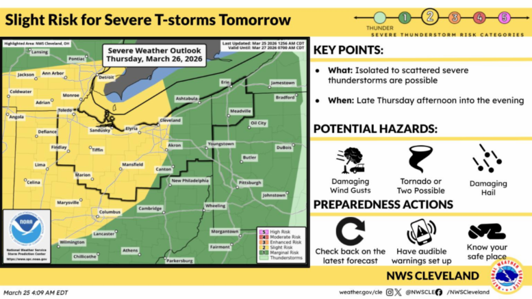
Wood County is under a “Slight Risk” (2 of 5) for severe weather Thursday evening.
Rain showers are possible beginning tomorrow afternoon into Friday morning. After 6 p.m., the chance for storms increases as the frontal boundary passes through the area. The current model shows the strongest storms for our area to be near 10 p.m. The associated risks with these storms are 40-50mph storm gusts, frequent lightning, heavy downpours with a possible tornado.
Currently, the most severe weather is expected to be south of our area. The Dayton area is forecasted for hail larger than 2 inches and a strong tornado will be possible. Today, there is some uncertainty with the start time, which could reduce the overall severe potential.
Updates will be provided as appropriate.