From WOOD COUNTY EMERGENCY MANAGEMENT AGENCY
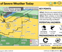
Wood County’s risk for severe weather has increased to an “enhanced risk.”
There will be possible showers starting around noon and continuing later tonight, March 26. Winds will be 10-15 mph, gusting up to 20-25 mph with high temperatures in the mid-70s.
Thunderstorms are expected to develop from noon – 10 p.m., with the greatest risk of severe weather between 3 – 8 p.m. Severe thunderstorms, with gusts 50-65 mph, hail up to 1-2 inches and tornadoes, will all be possible.
Rainfall up to an inch is forecasted, though locally higher amounts are possible with the potential for some localized flooding.
Overnight temperatures will drop into the lower-30s with flurries possible Friday morning.
The EMA will continue to monitor and provide updates as appropriate.