From CITY OF BOWLING GREEN CITY COUNCIL
Bowling Green City Council has announced the redistricting and updating of the city’s ward boundaries. Due to population growth and shifts, the district maps last revised in 2002 now show a 29% deviation between the largest and smallest ward’s population counts. This 29% deviation is above the population deviation of 10% that is generally accepted by the courts.
After the final map is chosen by city council, an ordinance detailing the ward boundaries will be passed in time for the next year’s 2027 municipal elections. The redistricting will reflect population shifts in the city and aim to guarantee fair and equal representation for all residents. City council is requesting public input in this process.
Community members are encouraged to participate in this process by attending one of the two public meetings and/or by creating and submitting their own ward maps for consideration.
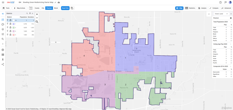
Ward maps can be created using the Dave’s Redistricting website, allowing users to suggest boundaries and provide input on what communities of interest should be kept together. A community of interest is an area whose residents share common neighborhood, economic, educational, transportation, cultural, or other community interests. Information on map creation and submission can be found here: https://www.bgohio.gov/721/City-Ward-Redistricting.
Community members are also encouraged to attend a public forum to learn more about the purpose of redistricting, discuss communities of interest, and receive assistance with creating maps. Residents are encouraged to bring a laptop, tablet, or other electronic device to participate in map creation. These events require no registration:
- Monday, Sept. 14, 6 – 7:30 p.m. – Veterans Memorial Building Meeting Room, 520 Conneaut Ave., Bowling Green
- Saturday, Sept. 19, 9 – 10:30 a.m. – Simpson Garden Park Building Meeting Room, 1291 Conneaut Ave., Bowling Green
Following these public meetings, city council will hold a public meeting to consider all maps and narrow the field to three finalists. The public will then have an additional opportunity to provide feedback on those maps before council selects a map on Oct. 5. The public will be invited to provide feedback for the finalist maps by emailing their city council representatives, whose contact information can be found here: https://www.bgohio.gov/460/City-Council.
The final map will be introduced and given its first reading on Monday, Oct. 5, at the regular meeting of city council.
For questions or comments, contact Katelyn Elliott, councilmember at-large, at kelliott@bgohio.gov; Jeff Dennis, council president pro tem, member at-large, at jdennis@bgohio.gov; or Mark Hollenbaugh, council president, member at-large, at mhollenbaugh@bgohio.gov.