The Wood County Emergency Management Agency has issued the following advisory:
The good news: NWS Cleveland has reduced the chance of ice, sleet and freezing rain for Wood County so we should not have to deal with that. Bad news is we can still expect 3.5” to 4” by the time most of us wake up in the morning with the possibility of an additional 1” of snow by 3 p.m. Thursday afternoon.
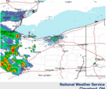
UPDATED FORECAST
Starting this afternoon expect snow to begin 3 – 4 p.m. continuing into the evening. The snow will increase around 6 p.m. with a possible 3.5” to 4” accumulation. Snow will continue throughout Thursday with up to 1” of additional snow.
Temperatures will drop Thursday night into Friday morning with a low of 7 degrees F with a wind chill of -4. Friday will remain cold continuing into Saturday when the high will be 34 degrees F. Chance of precipitation is 30 percent Saturday through Monday with a high temperature Monday of 45 degrees F.
This forecast is based on the center of Wood County. Please monitor the local media for the most current, up-to-date information for your area.