From WOOD COUNTY EMERGENCY MANAGEMENT AGENCY
A round of thunderstorms brought widespread flooding and some severe weather to many Ohio counties last night into early this morning. Another round of active weather is likely this evening.
What to expect:
Another round of showers and thunderstorms, potentially strong to severe, is likely between tonight 8 p.m. and 2 a.m. However, storms may develop earlier than 8 p.m. as instability continues to increase this afternoon.
Renewed flooding may quickly re-develop in areas that saw heavy rainfall and flooding Wednesday night or early this morning. A Flood Watch remains in effect for all Ohio counties in our forecast area through 8 a.m. Friday.
Dangerously high heat index values are in parts of northwest and north central Ohio, where Excessive Heat Warnings and Heat Advisories are in effect.
What has changed:
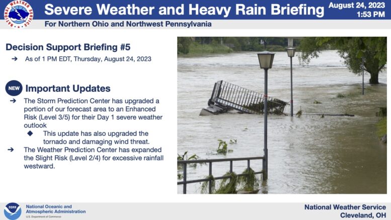
The Storm Prediction Center has upgraded their Day 1 Severe Weather Outlook to an Enhanced Risk (Level 3/5) for the northern part of Wood County and remains as “slight” for the majority of our area.
The Slight Risk (Level 2/4) for excessive rainfall was expanded westward.