By JAN LARSON McLAUGHLIN
BG Independent News
The completed Community Action Plan has given the city a lot to chew on.
“What’s that saying, ‘You can’t eat a horse in one bite,’” Assistant Municipal Administrator Joe Fawcett said about the plan. “There are so many things in there, we could get overwhelmed very quickly.”
The CAP is like a smorgasbord that the city will have to decide what it can handle now on its plate, and what needs to wait.
“It’s a lot,” Planning Director Heather Sayler said. “It can’t all be done at once.”
The plan, which cost the city $89,000, will be presented to City Council and City Planning Commission members on Feb. 28, at 6 p.m., in the Wood County Courthouse Atrium.
The city wants to make sure that others in the community join in the smorgasbord.
“We can’t shoulder this all on our own,” Fawcett said.
Those community partners include BGSU, businesses and residents.
“We also need neighborhoods to champion this,” Sayler said.
The Bowling Green Community Action Plan follows in the footsteps of the vision set by the Land Use Plan Update adopted by the city in 2014. It describes strategies to improve the quality of life for residents throughout the city, with a definite focus on the East Side and neighborhoods surrounding downtown.
The goals of the plan are generating a stronger owner-occupied household market, attracting and retaining professionals and young families, developing high-quality rental units, encouraging greater investment toward improving existing properties, and establishing better community connections.
The CAP has also been guided by comments received through the planning process, such as the need to address conflicts between homeowners and BGSU students, lack of housing diversity, ineffective zoning regulations, and misunderstandings about code enforcement.
Proposal for CAP
The plan offers “7 Bowling Green Principles” created to act as a tool to evaluate requests for new development and guide redevelopment and revitalization of the city’s core area.
The plan focuses on the East Side, which has been greatly impacted by the growth of BGSU and has become a magnet for student rental properties. Over the years, the character of the neighborhood has changed from single-family owner-occupied homes into an area dominated by rental properties geared toward students, compounded by aging housing stock and lowered property values.
The Land Use Plan emphasizes the opportunity to attract stable households to this community, making it walkable to downtown and the university.
But the plan warns that given the lack of private reinvestment, impact on Bowling Green’s quality of life and relationship to the success of BGSU, the risk of not adequately addressing these neighborhood issues would be a major setback for the city, its residents and property owners.
The Land Use Plan recommends broad initiatives intended to attract the city’s target market of young, educated professionals and starter families. The university, city, and local neighborhood organizations are encouraged to work together to promote a safe, sustainable and livable community.
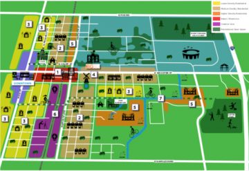
Following are the seven priority areas suggested in the plan. The costs to implement the proposals in the CAP range from “low cost” to more than $1 million. The plan identifies the partner most likely to lead each proposal – either the city, private funding, grants, neighborhoods, or BGSU.
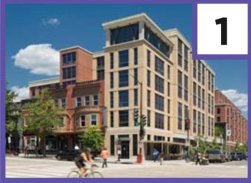
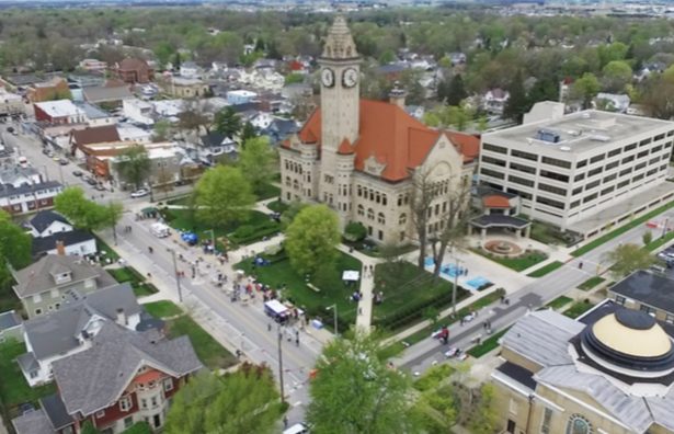
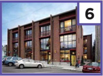
CORE DEVELOPMENT
Extends from the eastern edge of downtown and connects to BGSU along East Wooster Street. The area contains several properties whose design and development could improve the walkability of the area and provide a model for contemporary mixed-use development in other parts of the city.
This part of the plan calls for such changes as public streetscape improvements at the Thurstin-Manville intersection with East Wooster Street, and Court Street bicycle improvements.
TARGET REINVESTMENT
Primarily residential sections of the northeast and southeast neighborhoods that are currently showing signs of deferred maintenance and blight. The vision to improve these areas is to cater to their dominant populations, with redevelopment in the northeast area focused on families, post-collegiate professionals and BGSU faculty and the southeast area geared toward workforce housing.
This part of the plan suggests a rental property registration program with a landlord self-certification process to improve rental property conditions.

SINGLE-FAMILY REINVESTMENT
Includes the neighborhoods directly adjacent to the downtown and the blocks immediately to the north of Crim Elementary. Strategies for this priority area focus on stimulating private renovations, providing catalytic public improvements that can help stimulate reinvestment, and marketing the uniqueness of these communities to the broader region.
This part of the plan calls for the formation of local neighborhood groups, a rehabbers network with BGSU and Habitat for Humanity, a historic preservation ordinance, and further beautification of Ridge Park.
TRANSITIONAL DEVELOPMENT
The blocks of East Wooster Street between Troup Avenue and South Mercer Road have been slowly transitioning from a primarily single-family area to a mixed-use environment. Encourage continued transition into a walkable district that blends harmoniously with both the institutional uses on campus and the lower intensity single-family neighborhood to the south.
This part of the plan suggests improvements to BGSU campus entries especially at South College Drive and Mercer Road, design guidelines to ensure new development fits with the neighborhood, and possibly creating a walking trail around University Pond by the windmill.
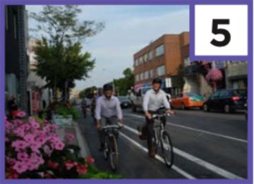
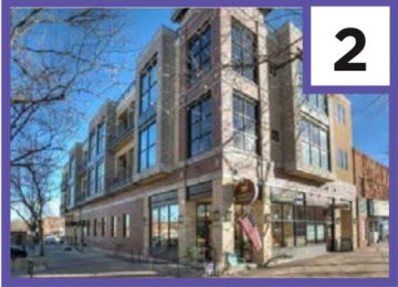
MULTI-FAMILY DEVELOPMENT
Includes the blocks immediately west of the BGSU campus and areas south of Crim Elementary and north of Carter Park. Promote medium and higher density residential development in these areas, coupled with new public investments in pedestrian and bicycle infrastructure.
This portion of the plan recommends reducing parking requirements to encourage walking and bike to campus, plus creating bicycle infrastructure and landscaping standards.
CREATIVE DISTRICT
The designation of a Creative District on either side of the CSX tracks between Enterprise and Summit Street on the west, Manville Avenue on the east, Clough Street on the north and Napoleon Road on the south. The district is intended to promote and incubate creative businesses and entrepreneurship opportunities, especially those focused on sustainability.
This part of the plan, in the long-term, calls for exploring uses like a kitchen incubator, greenhouses and artists spaces in the Creative District.
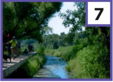
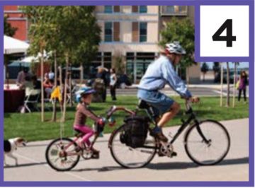
HIKE-BIKE TRAIL ALONG CREEK
The Hike-Bike Trail utilizes an existing creek and public right-of-way as an asset to begin to develop a recreational corridor and trail that can benefit current and future East Side residents. The Hike-Bike Trail recognizes the need for facilities that encourage active transportation as well as supporting neighborhood beautification and restoration of the natural environment.
This portion of the plan suggests construction of the trail connecting Mercer Road to Crim Elementary School, complete with landscaping, seating, signage and lighting.