By JAN McLAUGHLIN
BG Independent News
In an effort to make parents more comfortable allowing their children to walk or bike to school, Bowling Green City Council adopted a plan for a Safe Routes to School Program.
As part of that plan, two infrastructure “countermeasures” were approved Monday evening as the first of a long list of suggested steps.
First is the shared use path that the city has been planning between Crim Elementary School and Carter Park. The cost for that is unknown.
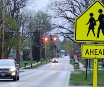
The second project will be pedestrian hybrid beacons added to two crosswalks, one at East Wooster and Enterprise streets, and one on West Poe Road near Darlyn Avenue, in front of the high school.
Those type of pedestrian beacons are currently in use on East Wooster Street, in front of Panera and between Manville and South College Drive.
The city already has plans to place a pedestrian hybrid beacon at the intersection of West Wooster Street and Maple Street. That project is expected to cost about $200,000.
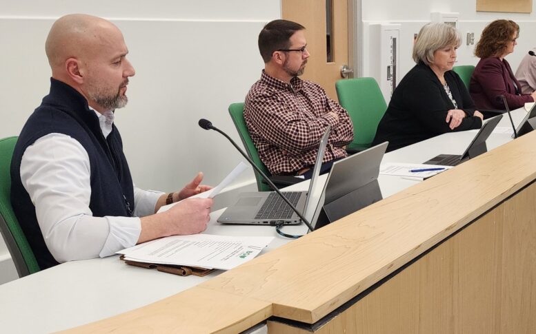
These projects were selected from a long list of countermeasures identified during the planning process for the Safe Routes plan, said Bowling Green City’s Public Works Director Mick Murray.
The plan includes 37 countermeasures involving infrastructure additions, such as sidewalks, street crossing beacons, shared use paths, better signage or traffic flow evaluations. The plan also includes 28 non-infrastructure measures involving education, encouragement, enforcement or engineering.
The shared use path and two pedestrian hybrid beacons were selected as the best two projects to move forward on.
“They’ll have the most impact,” Murray said after Monday’s meeting.
By City Council approving the routes to school plan Monday evening, the city can now pursue funding for the selected projects.
“I’m really excited about the opportunities discussed through this process,” Mayor Mike Aspacher said, with the end goal of more children walking and biking to school. “I think all of us would agree that would be beneficial.”
Because of the timing of the Ohio Safe Routes to School Program, council was asked to give the resolution three readings and adopt it Monday evening. Council member Jeff Dennis said he could not give it three readings because of its late arrival to City Council just hours before the 7 p.m. meeting.
“I’m a huge supporter of this initiative, but I received this at 4 o’clock,” he said.
Municipal Administrator Lori Tretter reminded that a public meeting on the subject was held last month, and the draft plan had been posted online. Dennis noted that he had attended the meeting and supports the efforts, but needs time to thoroughly read resolutions before voting on them. His was the lone “no” vote on the resolution.
During the public meeting held in January, it was reported that half of Bowling Green parents feel it’s unsafe to let their children walk or ride bikes to school.
Over the previous four months, city and school officials from all Bowling Green public and nonpublic/parochial schools worked with consultants on the Safe Routes to Schools travel plan and study.
The goal of Ohio’s Safe Routes to School Program is to assist communities with projects that encourage and enable children in grades K-12, including those with disabilities, to walk or bike to school safely.
Local planning consultants Reveille and Mannik Smith Group have been assisting the city in the plan’s development, meeting with school officials, and identifying areas along routes to schools in need of safety upgrades.
Glenn Grisdale, of Reveille, noted the national trend of fewer kids walking or biking to school. In 1969, an estimated 89% of children walked or biked to and from school each day, while 12% were driven. Those numbers have flip-flopped.
Parents see several barriers to letting their children transport themselves to school, Grisdale said. First is the longer distance to schools, with fewer neighborhood schools and more big schools built on the outskirts of communities. Second is concern over traffic, then adverse weather, and crime or danger.
City and school officials would like to alleviate some of those concerns – either through infrastructure or by education and encouragement.
The consultants visited every school in the city, including the five public school buildings, plus those at St. Aloysius, Montessori and BG Christian Academy. They observed the arrival and dismissal times at the schools to get an idea of any “pinch points” in traffic that present hazards.
They also mapped out all the pedestrian and bicycle crashes in the city for a three-year period. The consultants and city officials identified some possible infrastructure changes that could relieve some pinch points in the community.