BY SUSAN TEBBEN
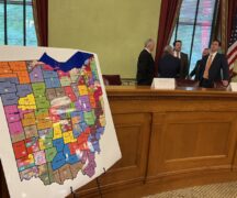
The first of what could be a few lawsuits challenging the Ohio congressional district maps was filed this week on behalf of Ohio voters.
The Ohio Supreme Court has received a lawsuit from the National Redistricting Action Fund, on behalf of 12 Ohioans living in the cities of Trotwood, Cleveland Heights, Oxford, Warren and North Canton, and others.

Law firms out of Seattle, D.C., and Columbus are listed as representatives of the Ohioans in the lawsuit, the first to come after the congressional maps were approved last week along largely party lines. The maps were contained in Senate Bill 258, which was signed by Gov. Mike DeWine on November 20.
The NRAF and the Ohioans argue that Article XIX of the Ohio Constitution — part of the explanation of the redistricting process passed by more than 70% of voters in a 2018 ballot initiative — is “mandatory and unequivocal.”
The constitutional provision says the General Assembly “shall not pass a plan that unduly favors or disfavors a political party or its incumbents” and “shall not unduly split governmental units.”
“The General Assembly and Governor (Mike) DeWine’s disregard for that mandate is equally clear: They enacted a congressional plan under which Democrats can expect to win just three of Ohio’s 15 congressional seats, making the 2021 Congressional Plan even more rigged than its predecessor and an outlier among partisan gerrymanders nationwide,” attorneys wrote in the lawsuit.
A spokesperson for DeWine said the governor’s office is reviewing the lawsuit, and referred back to DeWine’s comments when he signed the bill into law.
The arguments in the lawsuit mirror some made during hours of testimony on various maps proposed in the process, including the Senate GOP map that ended up being the map approved by the General Assembly.
“The process by which maps were considered was a disgraceful subversion of constitutional reforms designed to ensure meaningful public comment before a congressional districting plan is adopted,” the lawsuit states.
The lawsuit claims map-drawers “subordinated traditional redistricting criteria, tore communities of interest apart and diluted the voting power of Black Ohioans.”
The Ohio Redistricting Commission is also named as a party in the lawsuit, despite the fact that they went past their Oct. 31 deadline without approving a map or proposing a map to the General Assembly for review.
The lawsuit said the ORC was “intended to serve as a backstop” if the GA failed to pass a map by Sept. 30, and accused House Speaker and ORC co-chair Bob Cupp of ignoring fellow co-chair state Sen. Vernon Sykes’ “entreaties to schedule commission meetings.”
“As a result, for the entirety of October, the commission laid dormant,” attorneys wrote. “No hearings were held, and no maps were considered.”
The commission held one hearing on Oct. 28, in which map presentations were made by public citizens and anti-gerrymandering groups, but no vote was conducted.
According to attorneys in the court challenge, the maps proposed by the GOP in November committee hearings “put the 2011 gerrymander to shame,” and cut communities of interest along with splitting counties, cities and townships.
The lawsuit notes urban areas in southwest and northeast Ohio specifically were split “unnecessarily for the patently transparent purpose of minimizing Democratic voting power — particularly that of Black voters.”
Bill sponsor state Sen. Rob McColley defended splits made in the final map during a presentation to a House committee the day before the map was passed by the full House. When asked specifically about Hamilton County, McColley said generally ““the constitution, in our reading, and I think it’s pretty clear, allows us to split up to five counties twice.” READ MORE
What Ohio’s Senate map says about GOP redistricting strategy
Early next month, new state legislative districts go before the Ohio Supreme Court. The congressional map approved last week is on its way to court, too. In both cases, Ohio Republicans controlled the process throughout, and approved maps that garnered no support from the minority party — directly at odds with the stated intent of the constitutional amendments overwhelmingly approved by voters. These new lines are transparently partisan, but they’re built to be right at the bleeding edge of defensible. The new Senate plan offers a glimpse at state leaders’ strategy.
Packing and cracking in Cincinnati and Cleveland
Three different state senators will represent portions of Hamilton County. Cuyahoga will get four. They’re the second and third most populous counties in the state, so splitting the counties was likely unavoidable. But political scientist David Niven takes issue with how those splits were made.
“Gerrymandering isn’t just about drawing a bunch of districts for your party to win. It’s also about drawing districts for the other party that they can’t lose,” Niven explained. “You maximize the number of their voters who are bunched together, so they harm the dominant party in as few districts as possible.”
This practice, known colloquially as packing and cracking, influences outcomes by changing what researchers call the efficiency gap. Efficiency has to do with the relative weight, or power, of a given vote. Casting a ballot in one party’s stronghold is less efficient, for instance, than casting it in a toss-up race. When the margins are tighter, a single vote means more. READ MORE


