The Wood County Emergency Management Agency has issued the following advisory:
Just to give you quick information on today’s weather system. We are working to get you a more detailed version of what we expect to see today, but want to give you as much lead time as possible.
For municipalities, public service and public safety I would plan on increased calls for down trees, power lines and utility disruptions. We would recommend getting your plans in place. This system does have the potential for tornados as well.
From the National Weather Service:
Purpose: The purpose of this advisory is to provide awareness to state and local partners of the potential for severe weather forecast for this afternoon and evening.
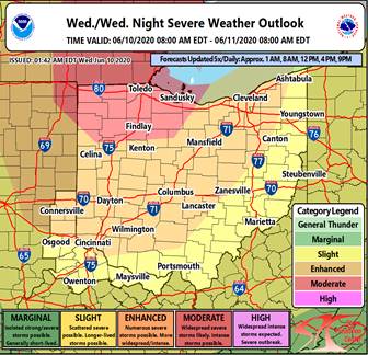
Forecast
The National Weather Service has reported that there is a MODERATE risk of severe beginning on the afternoon of Wednesday, June 10, through the early morning of June 11. Damaging winds with thunderstorms have the potential to be particularly strong (gusts of 75mph or greater) in areas north of I-70 and west of I-71.
Potential Threats:
· Damaging Wind: Damage to trees, power lines, and structures.
o Area wide, greatest threat NW OH
· Tornado: Damage to trees, power lines, and structures
o Area wide, especially western and northern Ohio
· Hail: Damage to roof vehicles, and crops
o Area wide
Timing:
· Damaging winds: 2PM-Midnight
· Tornado: 3PM-10PM
· Hail: 2PM- Midnight
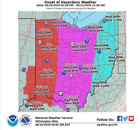
· Onset of Hazardous Weather: