By JAN LARSON McLAUGHLIN
BG Independent News
Downtown Bowling Green has some stories to tell.
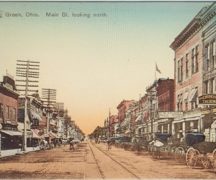
Its buildings once held grand hotels, an opera house and theater. Its streets ran with horse-drawn buggies, and trolley lines. Its businessmen were often veterans of the Civil War.
The downtown hosted famous visitors like Hollywood heartthrob Clark Gable, and was the site of a shootout with infamous gangster bank robber Pretty Boy Floyd. It was where Jimmy Hoffa came for a quick, few questions asked, wedding.
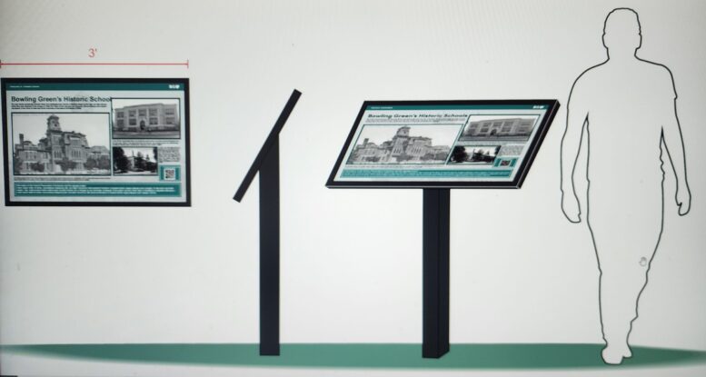
To paint a picture of the city’s storied past, a series of 15 or 16 historic markers are being designed for the blocks in the downtown area. The signs will point out sites known for their architectural feats, their famous owners, or disastrous fates.
The historic interpretive signs – somewhat similar to those in downtown Perrysburg – will highlight school sites, theaters, butcher shops, drug stores, hotels, churches, funeral homes, banks, a ballroom and an opera house.
The city’s Historic Preservation Commission was awarded a grant to place the historical interpretive signage in the downtown area. The signs will celebrate the city’s landmarks, pivotal events, and influential people who have shaped the community over the years.
The signs will be made of materials to last at least two decades. The narratives will be short enough to not discourage pedestrians from stopping to read, said Heather Sayler, the city’s planning director who oversees the historic commission.
The grant funds will be used to design, produce, and install the historical interpretive signs in strategic locations throughout the downtown. Historians, designers, and the HPC will collaborate closely to ensure that the signage accurately reflects the city’s historical significance.
Members of the Friends of Bowling Green’s Historic Preservation Commission have been enlisted to help gather the history along the downtown blocks and write narratives for the signs. Anyone who has photographs of the historic downtown is asked to email them to Sayler at HSayler@bgohio.org no later than Dec. 15 for possible use on the signs.
Following is a draft list of the signs planned for the downtown area:
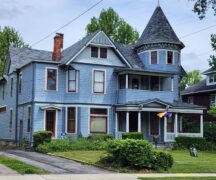
- A general history of downtown architecture, dominated by Queen Anne and Classical Revival, with some Italianate and Romanesque styles, mostly built after the Civil War.
- Information about former schools, with that sign to be located in Wooster Green.
- A description about the Boom Town area created by revenues from the oil boom, also to be located in Wooster Green.
- The area of North Church Street and North Main Street once used for the old post office, school, library and city hall. The sign will be placed between the new city building and the library.
- The northwest block of downtown, focusing on the ClaZel theater, Masonic Temple, butcher shop, drug store and other businesses.
- The police building, on West Wooster Street, telling about the former courthouse, town hall and fire station.
- The southwest block of downtown, highlighting the “Union Block,” the classic Lehmann Building, the Brown Hotel and former bank.
- Churches, describing some current churches around downtown, architecture, and some that have been changed into homes, with that sign being posted in Wooster Green.
- Northeast Block, including the “Lincoln Block” which has the oldest block dating back to 1874, and site of a famous truck accident.
- Southeast Block, which boasted the Millikin Hotel, an opera house/ballroom, earlier hotel, plus stories of Clark Gable, oil money and Pretty Boy Floyd.
- Hankey Block, established by a veteran of the Civil War, during the Oil Boom days.
- Wood County Courthouse, which is on the National Register and is a locally designated historic landmark, located on East Court Street.
- East Court Street area, with Trinity United Methodist Church, the old Women’s Club and houses used for “marriage mill.”
- Southeast corner of South Prospect Street and East Wooster Street, featuring the old armory and funeral home, known to have one of the first female embalmers and funeral directors in the country.
- Northeast corner of North Prospect Street and East Wooster Street, highlighting the former Ross Hotel and church.
- Possibly a sign dedicated to transportation in the city, including interurban lines, trolley cars, horse and buggies, bicycles, trains and early vehicles.
The project is made possible in part by a federal grant from the U.S. Department of Interior, National Park Service, and administered by the State Historic Preservation Office of the Ohio History Connection.


