Erin Konecki, Emergency Management Agency deputy director for Wood County, has issued the following advisory:
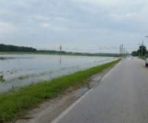
The threat of flooding along area rivers will increase later this week, as warmer temperatures and rainfall arrive across northern Ohio and northwestern Pennsylvania. The combination of potentially heavy rainfall and significant snow melt is expected to cause rises along area rivers by Thursday. Attached is a briefing from the Ohio River Forecast Center regarding the flood potential across the region.
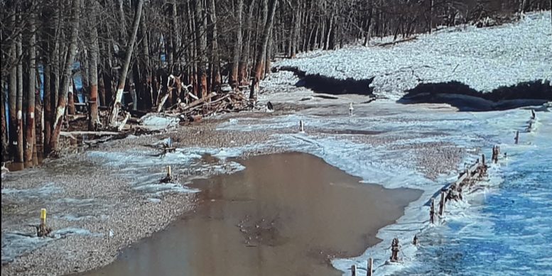
Although the current risk of flooding applies to the entirety of northern Ohio and northwestern Pennsylvania, the briefing highlights the potential for significant flooding across north central and northwest Ohio. There is also an increased risk for ice jams and ice jam flooding in traditional areas given the current amount of ice on the rivers. Please stay tuned for additional information throughout the week as details become clearer.
The following resources are available for monitoring flood potential as the week progresses and can be bookmarked for the latest information:
NWS Cleveland River Observations and Forecasts (AHPS)
NWS Cleveland Hazardous Weather Outlook Text Product (HWO)
NWS Cleveland Website for current watches and warnings
NWS Cleveland Quick Brief Webpage, which includes the latest briefing slides