The Wood County Emergency Management Agency has issued the following advisory:
There is a threat for severe weather late today through Saturday evening. We have attached some infographics. As always, make sure you are signed up for CodeRED and have your phones charged in order to access to updated information. We will continue to push out information as it comes in.
What to expect:
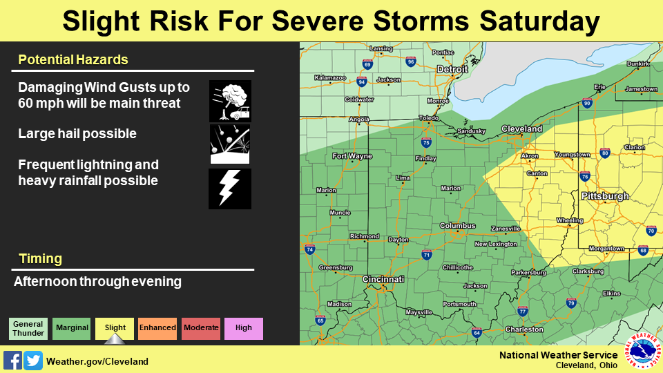
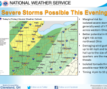
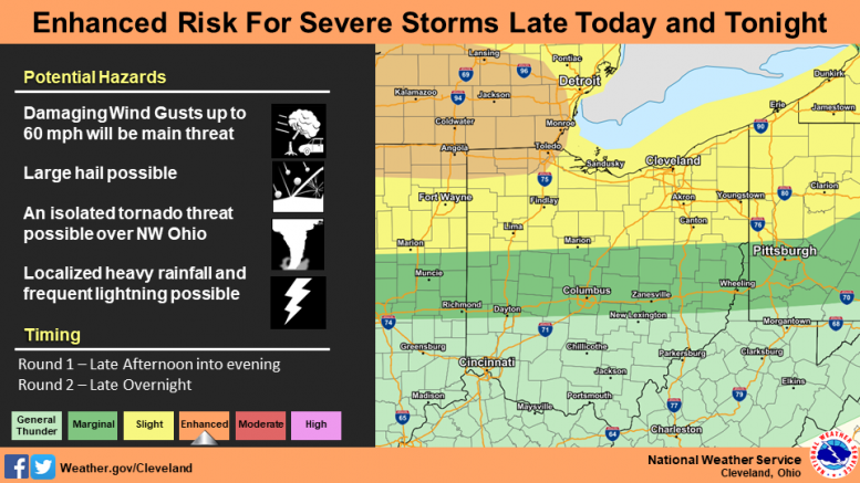
A slow moving front will start to move across the region late today through Saturday evening. Atmospheric conditions will be favorable for a couple rounds of potential severe thunderstorms along and ahead of the front. At this time, the primary threat will be damaging wind gusts up to 60 mph followed by large hail possible. Because of the strong wind shear, there will be a threat of an isolated tornado threat possible over northwest Ohio. If a couple rounds of thunderstorms develops and moves over the same areas late today through Saturday evening, localized heavy rainfall may be possible and slight flooding threat may exist.
Timing:
Potential Round #1 – Late this afternoon into the evening
Potential Round #2 – Late overnight tonight
Potential Round #3 – Saturday afternoon and evening
What has changed:
SPC has updated the severe weather outlook to an enhance risk for later today and tonight for northwest Ohio.