By JAN LARSON McLAUGHLIN
BG Independent News
The city of Bowling Green will soon be using a drone to help size up infrastructure projects. But city officials want to assure residents that the eye in the sky will only be focused on streets – not private property.
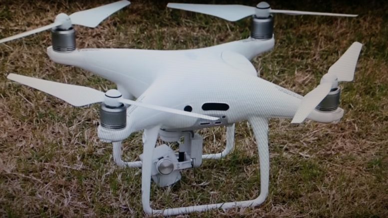
The drone, which was seized during a criminal investigation, will be used by the city’s Geographic Information System (GIS) staff to prepare for infrastructure projects such as water line replacements and road repaving projects.
The drone, which has made some test flights, is a Dji Phantom 4 Pro, which is approximately 6 inches tall with a wing span of 12 inches.
According to Assistant Municipal Administrator Joe Fawcett, a typical flight for city projects will last up to 30 minutes with the drone mapping images captured at an altitude of 20–100 feet depending on conditions.
The drone will fly the designated route at a speed of approximately 15-20 mph.
Fawcett stressed that the drone will only operate over the public right-of-way, with images taken straight down. Private property will not be mapped or flown over.
“This will absolutely not be flown over private property,” Fawcett said.
The street images from the right-of-way will then have existing aerial photos stitched in.
The benefit of having the drone images is that they will be “way more detailed and current,” than aerial shots that may be a couple years old, Fawcett explained.
Before a flight occurs, residents along the street will be notified and the street will be temporarily closed to traffic. In most cases, the drones will go unnoticed.
“They may hear it, but I doubt it,” Fawcett said. “They are really quiet.”
The drone will be under the direct supervision and within eyesight of a city employee who has been certified by the Federal Aviation Administration as a “Pilot In Command.”
According to Fawcett, the city must file a pre-flight plan to designate the route that will be flown. Those plans must go to the Wood County Regional Airport, Bowling Green State University and Wood County Hospital.
The benefits of using this system versus traditional methods are numerous including increased efficiencies during project preparation and having the most up-to-date map of project areas, Fawcett stressed.