The Wood County Emergency Management Agency has issued the following advisory:
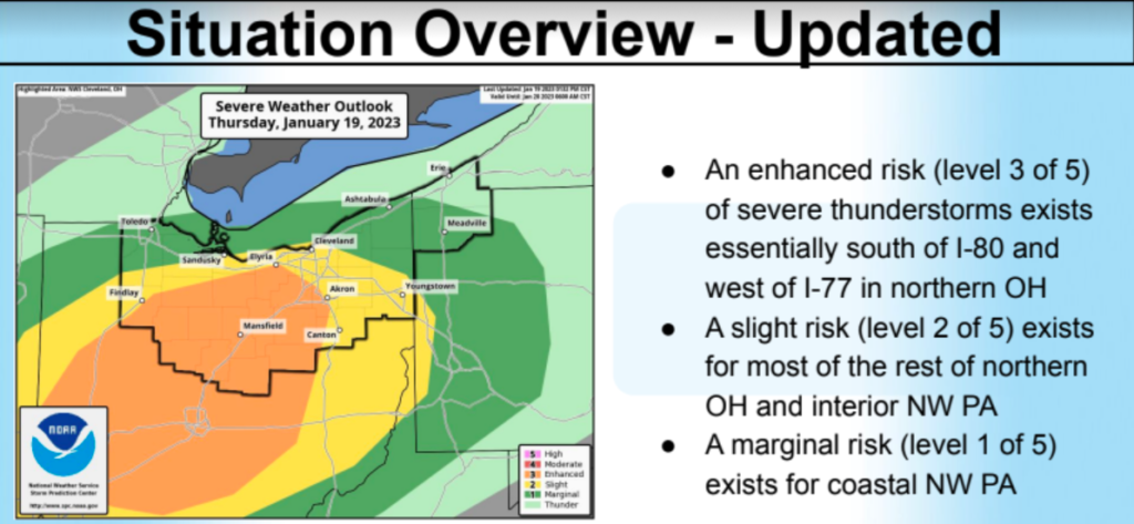
This afternoon’s National Weather Service update continues predict a fast moving storm though our area between 4-6 p.m. today (1-19-23). The Severe Thunderstorm Risk Category has not changed for Wood County: north of Route 6 “Marginal” risk and south of Route 6 in a “Slight” risk.
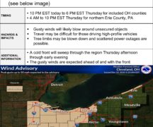
The primary threat continues to be high wind 45-55 mph with gusts potentially up to 80mph. If there are 80mph wind gusts in your area NWS Cleveland will issue a Wireless Emergency Alert (WEA) to your cell phones. Large hail and isolated tornados cannot be ruled out.
The timing of this event will be during the evening commute for many of us. Please check the weather near you before leaving and have a plan should severe weather occur during your commute. Monitor local radio stations rather than satellite radio while driving and always have multiple ways of receiving weather alerts.