The Wood County Emergency Management Agency has issued the following advisory:
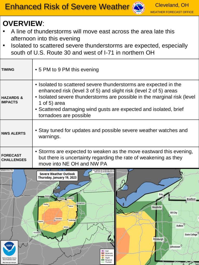
The National Weather Service has increased the risk of severe weather in our county. As of 9 a.m. this morning (1-19-23), all of Wood County south of Route 6 is under a “Slight” risk for severe weather. Central and western Ohio have been upgraded to an “Enhanced” risk for severe weather. In short, the risk of severe weather for Wood County is increasing.
While a few showers may develop as early as 2-3 p.m., the main threat of severe weather will be between 4-7 p.m. These storms will be capable of producing wind gusts up to 50-60 mph.
There is also a chance for large hail and very slight chance of an isolated tornado.
For many of us, the timing of 4-7 p.m. will be during peak travel hours on the road. We encourage everyone to monitor conditions and have a plan should a thunderstorm warning be issued during the time of your commute.
This type of weather activity is rare for NW Ohio in January, but one tornado warning has already been issued this year in SE Ohio. Severe weather can happen at any time, so be prepared.
General precautions:
Make sure all loose outdoor items have been secured.
Have multiple ways to receive warning notifications: NWS Weather Radio, Wood County Mass Notification System CodeRed , local media and phone apps. Know where you will go if there is a tornado warning. If you have not registered for CodeRED the link is https://public.coderedweb.com/CNE/en-US/BFAB7B074BCD
Make sure you have working flashlights and cell phone batteries are fully charged.
We will continue to monitor local weather conditions and provide updates as appropriate.