By JAN LARSON McLAUGHLIN
BG Independent News
Half of Bowling Green parents feel it’s unsafe to let their children walk or ride bikes to school.
City and school officials would like to change that.
Over the past four months, city and school officials from all Bowling Green public and nonpublic/parochial schools have worked with consultants on a Safe Routes to Schools travel plan and study.
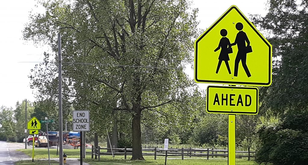
The goal of Ohio’s Safe Routes to School Program is to assist communities with projects that encourage and enable children in grades K-12, including those with disabilities, to walk or bike to school safely.
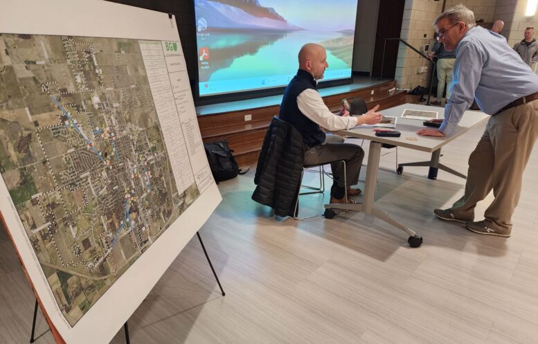
On Wednesday evening, the data gathered and possible proposals were presented to the public to get citizen input. Local planning consultants Reveille and Mannik Smith Group have been assisting the city in the plan’s development, meeting with school officials, and identifying areas along routes to schools in need of safety upgrades.
Glenn Grisdale noted the national trend of fewer kids walking or biking to school. In 1969, an estimated 89% of children walked or biked to and from school each day, while 12% were driven. Those numbers have flip-flopped.
Parents see several barriers to letting their children transport themselves to school, Grisdale said. First is the longer distance to schools, with fewer neighborhood schools and more big schools built on the outskirts of communities. Second is concern over traffic, then adverse weather, and crime or danger.
City and school officials would like to alleviate some of those concerns – either through infrastructure or by education and encouragement.
The consultants visited every school, including the five public school buildings, plus those at St. Aloysius, Montessori and BG Christian Academy. They observed the arrival and dismissal times at the schools to get an idea of any “pinch points” in traffic that present hazards.
They also mapped out all the pedestrian and bicycle crashes in the city for a three-year period. The consultants and city officials identified some possible infrastructure changes that could relieve some pinch points in the community.
For example, the jogged corner involving Kenwood Avenue, Sand Ridge Road and South Church Street poses potential hazards. So a suggested change is to straighten up the intersection by possibly shaving off part of Bellard Park, Grisdale said.
And at Crim School, where traffic is tight during drop-off and pick-up, the planners suggested extending Crim Street through to Third Street to allow another outlet for traffic.
And at the high school, it was suggested that sidewalk gaps be filled on the east side of Fairview Avenue, north of West Poe Road.
At St. Aloysius, the possibility of making South Enterprise Street a one-way route was also noted.
Parents responding to a survey mentioned the lack of sidewalks and bike lanes as a problem. Half of the parents said their children have asked to walk or bike to school.
Crim Elementary Principal Zeb Kellough and Kenwood Elementary Principal Michel Bechstein said they believed safety measures near their schools could make parents more comfortable allowing their children to walk or ride bikes to school. Both Bechstein and Kellough said they too would feel better about students walking or biking if infrastructure was improved.
Bowling Green City’s Public Works Director Mick Murray listed some steps the city has already taken or is planning to increase pedestrian safety:
- Three rapid flashing beacons at pedestrian crossings on Thurstin Avenue.
- Rapid flashing beacon at Sand Ridge Road and South Maple Street, by the Montessori School, later this year.
- Pedestrian hybrid beacon at West Wooster Street and Maple Street, later this year.
- Some type of pedestrian beacon where the Slippery Elm Trail crosses West Gypsy Lane Road.
- Two pedestrian hybrid beacons on South Main Street between Napoleon Road and Gypsy Lane Road.
- Shared use path between Crim Elementary and Carter Park.
- Shared use path along Brim Road, connecting Cogan’s Crossing housing development to Bowling Green middle and high schools, plus to the community center in 2026.
The plan described Wednesday evening includes 33 countermeasures involving infrastructure additions, such as sidewalks, street crossing beacons, shared use paths, better signage or traffic flow evaluations. The plan also includes 28 non-infrastructure measures involving education, encouragement, enforcement or engineering.
The next step for the Safe Routes to School plan is to take the feedback from Wednesday’s meeting and have a draft plan ready by Monday to post on the city’s website. The public will then have a two-week period to submit comments, Grisdale said.
A proposal will then be submitted to ODOT in early February, with a grant application to follow by March 1.
The Ohio Safe Routes to School Program is funded at $5 million annually, with money available for:
- Infrastructure projects within two miles of schools serving K-12 students. ODOT will reimburse up to 100% of eligible costs for all phases, including preliminary engineering, detailed design, right-of-way, construction, and construction engineering. Project limit: $500,000.
- Non-infrastructure activities such as education, encouragement, enforcement or evaluation. Non-infrastructure funding may be requested for assistance with the development of plans. ODOT will reimburse up to 100% of eligible costs for items such as training and materials, program supplies, small safety and education incentives, and public awareness campaigns. Project limit: $60,000 or $120,000 for a two-year project.
Safe Routes to School: https://www.transportation.ohio.gov/programs/safe-routes-srts/safe-routes-to-school-srts