Wood County will has the potential for several weather events over the next two days (June 9 & 10). These systems will occur mainly in the evening and will have the potential to create severe weather patterns. Wednesdaywill be the greatest concern for severe weather. This type of early developing storm can have supercell characteristics before they congeal into a line of severe storms likely in eastern Ohio.
From NWS Cleveland What to expect:
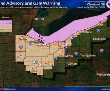
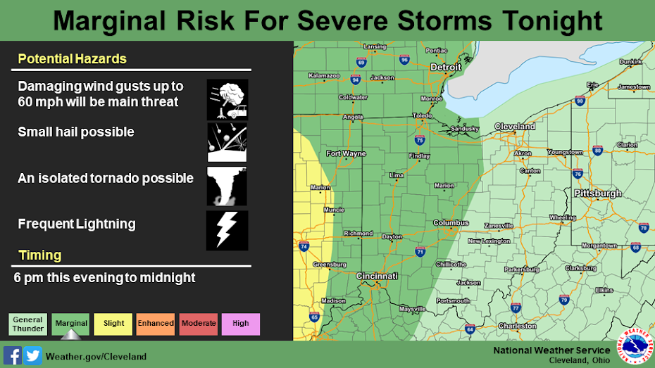
The outer fringes of the remnant low pressure system of Cristobal will skirt across western Ohio as a warm front. This will bring a potential for a few strong to isolated severe thunderstorms this evening. The main threat will be damaging wind gusts up to 60 mph, but an isolated tornado cannot be ruled out.
For Wednesday, strong non-thunderstorm winds are expected. Winds will generally be from the south with gusts up to 35 mph during the afternoon hours, mainly over north central and western Ohio.
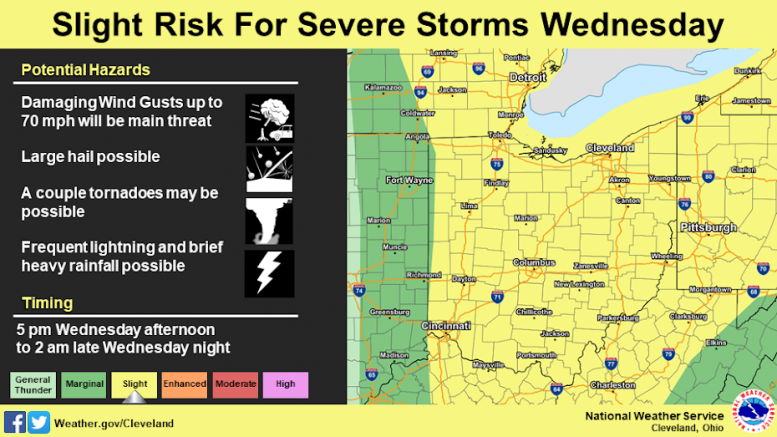
A cold front will move across the region late Wednesday afternoon into the overnight hours. Conditions look favorable for strong to severe thunderstorms along and ahead of the cold front. All modes of severe weather are possible, but at this time, the primary threat appears to be damaging wind gusts up to 70 mph. A couple of tornadoes and isolated large hail are also possible with this system. Any thunderstorms that move over the region will be fairly efficient with rainfall. Areas that receive rain tonight could have some flooding issues with the heavier rain on Wednesday.
It does appear NW Ohio will see some type severe weather over the next two days. As always, now is the time to prepare for severe weather not when it is occurring. Please make sure you are monitoring weather conditions and have a plan should severe weather occur. The EMA will continue to monitor weather conditions and will provide updates as appropriate.