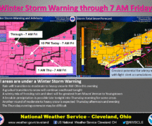
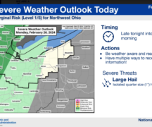
The Wood County Emergency Management Agency has issued the following advisory:
What to expect:
A very strong thunderstorm complex is currently ongoing across Iowa this afternoon. This complex is expected to continue to track eastward throughout the afternoon and evening hours.
Confidence remains low on whether the thunderstorms remain strong to severe as they reach the vicinity of Northwest Ohio.
Timing for the thunderstorm complex to arrive across Northwest Ohio would be around 9 p.m., and is expected to weaken across the area through 2 a.m. as it tracks towards the I-71 corridor. If the thunderstorm complex remains strong to severe, the highest threat would be damaging wind gusts.
What has changed:
Slight risk has expanded east along the I-75 corridor. Marginal risk was expanded to just west of the I-71 corridor.
The following links can be bookmarked for the latest information:
Updates from the Storm Prediction Center can be found at www.spc.noaa.gov/


