The Wood County Emergency Management Agency has issued the following advisory about impending severe weather:
What to expect:
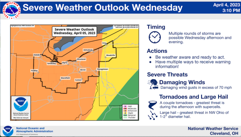
- Showers and thunderstorms are expected to develop on Wednesday afternoon and evening. There could be two rounds of storms – one well ahead of a cold front in the afternoon and another during the evening closer to the front.
- Storms have the potential to become severe with all severe hazards possible, including damaging winds, tornadoes, and hail
- Non-thunderstorm wind gusts will be strong once again on Wednesday with southerly wind gusts in excess of 40 mph possible.
- Uncertainty remains in the forecast. The degree of cloud cover and showers during the first half of the day may impact strength and coverage of storms in the afternoon.
What has changed:
- No significant changes at this time.
- The threat of severe weather continues on Wednesday. Review severe weather safety plans and stay tuned for updates on Wednesday. This may include severe weather watches and warnings.
The following links can be bookmarked for the latest information:
Updates from the Storm Prediction Center can be found at www.spc.noaa.gov/
As storms develop, Local Storm Reports can be found here.
The latest forecast for your location can be found by clicking on the map at www.weather.gov/cle.