By JAN LARSON McLAUGHLIN
BG Independent News
The new Wood County Land Use Plan does more than give lip service to organized development – it’s added some teeth.
Recently the Wood County Commissioners voted unanimously to adopt the new land use plan, which will direct growth to areas with the roads, waterlines and sewer lines to handle it – while maintaining the agricultural and natural areas that are also important to the county.
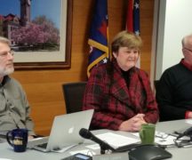
“It’s nice because you have zoning, and zoning is great for directing growth, said Dave Steiner, director of the county planning commission. But the land use plan takes it a step further. “Without a plan, you don’t have something to fall back on.”
So if a developer wants to rezone some acreage in the middle of prime farmland for industrial use, the land use plan helps back up the rejection by the county and townships, Steiner said.
The plan takes into consideration the latest census information, demographics and development.
The plan also looks at “reinvestment areas,” where previous development has “fallen by the wayside” and may need a jumpstart with brownfield development, Steiner said.
And the plan defends agricultural areas that are still vital to the county’s economy.
The county had outgrown the last land use plan, which had been adopted in 2007.
“It was not nearly as comprehensive as this one,” Steiner told the commissioners.
The guiding principles of the land use plan are as follows:
- Support sustainable land use and development patterns, and identify and protect natural and environmental resources.
- Protect prime agricultural land and support agricultural production.
- Target economic development areas to support and attract employment generating uses.
- Identify sensitive natural areas for protection, possible areas for recreation in coordination with these natural areas, and historic or cultural sites to protect.
- Make efforts to promote redevelopment and reinvestment in areas with existing infrastructure and services and strategically manage the outward expansion of suburban development particularly in townships with the greatest growth pressures.
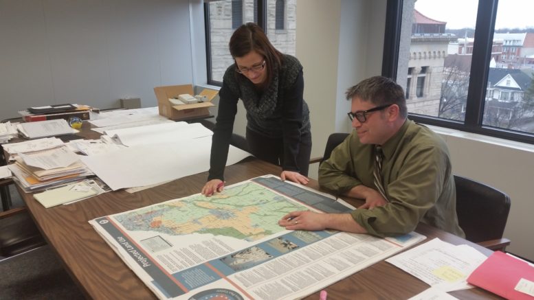
The land use plan was developed by McBride Dale Clarion from Cincinnati, after multiple public meetings to gather citizen input.
“I feel we have really addressed the issues” that impact land use in the county, Steiner said.
The plan is available for public viewing at the county planning commission, at the county commissioners office, and online at http://planning.co.wood.oh.us.
The land use plan can be used by other governmental entities in the county to help steer growth as well, according to Emily Crow, who helped develop the plan. “There was a very conscious effort to create a tool that the townships can use and the smaller villages can use.”
Because the plan is more detailed than those in the past, it gives more guidance, yet “this adds a lot more flexibility,” Crow said. “The purpose of all this is to give a flexible tool that can work for all the townships.”
The ultimate goal is to help the county grow in healthy ways. “When it happens, we want that growth to be good for the community,” she said.
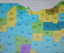
The plan identifies the following areas:
- Growth management areas, which have dense transportation networks, access to sewer and water services, and are areas already exhibiting growth pressures.
- Rural management areas, which are predominantly agricultural and low density rural residential.
- Enhancement areas, which have existing development that is currently stable but may experience change over the coming decades. Most of these areas are residential, but has some retail development.
- Reinvestment areas have existing development and infrastructure but may be showing signs of disinvestment, vacancy or potential for reinvestment.
- Targeted economic development areas, where the county and townships would like to focus economic development.
- Natural resources/water quality management areas, particularly in the Maumee and Portage River areas, which the county wishes to protect.
Wood County Commissioner Doris Herringshaw said the land use plan it easy to use. She has already heard from township officials who are making use of it.
“It’s a nice document. I appreciate all the work that went into it,” Commissioner Craig LaHote said.
So far, Perrysburg Township is the only township in Wood County that has its own land use plan. But Liberty Township is now considering creating its own.
“We’re hoping townships can use this as a guide or building block to work on their own,” said Katie Baltz, of the county planning commission.