Brad Gilbert, Wood County EMA director, has issued the following advisory:
The EMA has just completed a conference call with the National Weather Service concerning a significant storm system moving into Ohio this weekend. The remnants of tropical storm Gordon will be combining with another storm system and a cold front over Ohio which will bring extremely heavy rain to most areas of Ohio. Attached is the current estimate of rainfall for this storm system across Northern Ohio through Monday morning.
A significant portion of Wood County is in the 2” – 3” rainfall category. Please keep in mind that these are current estimates and a slight change(20-30 miles) in the storm track could easily shift even heavier rain totals over Wood County.
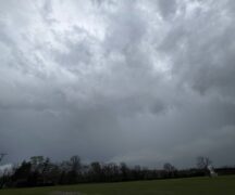
Scattered showers are possible Saturday afternoon with steadier rain starting to move into the area Saturday evening. Steady rain will become even more likely towards and after midnight Saturday and through most of the day on Sunday. Thunderstorms will also become possible on Sunday with very gusty winds even outside of thunderstorms.
Training thunderstorms and flash flooding will be the first concern on Sunday as rain could accumulate quickly in low lying areas (roads and land). Stream and river flooding issues will also become possible by Sunday evening and into Monday.
The Portage River basin will likely see 2”-3” of rain which will cause a rapid rise in the Portage River on Sunday. Low lying areas will likely become inundated by late afternoon and evening on Sunday. Persons living along the Portage River should keep a very close eye on conditions on Sunday into Monday. Minor flood stage for the river is likely, but if rainfall in the river basin approaches or exceeds 3” of rain, Moderate flood stage will be possible with a small chance of Major flood stage (again if rainfall starts exceeding 3”). Preparedness and precautions will be the key to reducing the impact of flooding on lives and property.
EMA will receive an update briefing from the NWS at 5:00 p.m. today (Sept. 7). We will issue another email with updated information immediately following their update. Updated information will also be posted on the EMA Facebook page throughout the weekend. Please use extra caution when driving on Sunday and Monday as roadways may have ponding water on them and low lying areas in roadways may have significant water standing in them. If you live in a flood prone area, please monitor conditions via NOAA Weather Radio or local media very closely this weekend.