By JAN LARSON McLAUGHLIN
BG Independent News
The updated bicycle plan for Bowling Green kicked into the next gear after getting a thumbs up Wednesday from the city’s Planning Commission.
The plan will now go back to City Council, which will hold a public hearing on the updated Bicycle Facilities and Destinations Map in the Transportation Section of the city’s Comprehensive Plan.
Infrastructure options for bicyclists in Bowling Green were examined in the updated bicycling study by Mannik & Smith.
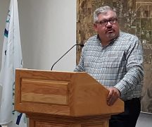
Public Services Director Joe Fawcett explained to Planning Commission members that the city’s current plan for bicycles lacks specificity and does not reflect current bicycling trends.
The new study found that road diets, a downtown bike bypass, and more use of pedestrian beacons could help motorists and bicyclists better share roadways in Bowling Green.
A road diet in Bowling Green could make bicyclists more comfortable riding on some city streets. Many city streets have 12-foot wide lanes, but ODOT allows 10-foot lanes – which leaves four feet for a bike lane, according to Pat Etchie, of Mannik & Smith, who presented the updated bike information to City Council in September.
The updated bicycling study in Bowling Green also explained how a downtown bike bypass route could help keep cyclists off downtown sidewalks. The bypass would run on Prospect and Church streets, with several businesses already having bike parking accommodations behind their shops, Fawcett said.
The plan comes with a map of bicycling accommodations already in place, those currently underway, those in the planning process, and those further down the road.
Included in the plan are:
- Potential shared road corridors (shown in magenta), which could use a mix of sharrows, signs or on-street bike lanes.
- Future planned shared use paths (in green), which include the project planned on South Main Street from Napoleon to Gypsy Lane, and from the high school to the community center and Cogan’s Crossing development.
- Potential shared use paths (in blue) shown on Haskins Road, Newton Road, North College Drive, East Poe Road, Mercer Road, East Wooster Street, and South Dunbridge Road.
- Downtown bicycle bypass route (in yellow) on Prospect Street and Church Street.
- Existing shared use paths (in orange) including the section of East Wooster Street over Interstate 75, and from Kenwood Avenue to the Slippery Elm Trail.
- Existing sharrows (in dotted yellow) on portions of Conneaut and Fairview avenues, plus Manville and Thurstin avenues.
- Slippery Elm Trail (in pink).
Planning Director Heather Sayler said the bicycle plan is intended to provide links between various destinations in the city.
“We’re really trying to connect those dots,” Sayler said. “We’re trying to make our roads usable for all users.”
The plan is also intended to be put to use with future paving projects – so when a street is in line for repaving, it will already be determined if it should include bicycle treatments.
Planning Commission Chairman Bob McOmber said he was impressed by the depth of the study – which showed much effort to meet the needs of local bicyclists, he said.
Planning Commission member Mark Remeis also voiced his support of the plan.
“I’d like to see it happen sooner than later,” Remeis said.
The information gathered by Mannik & Smith showed the highest crash rates involving bicycles and motor vehicles are found on Main Street. The installation of pedestrian beacons on East Wooster Street has reduced car-bike crashes on that road, Etchie said.
Etchie suggested that rather than proposing bicycle facilities along Main Street, that the city make intersection-related safety improvements to allow safer crossings of Main Street for bicyclists and pedestrians – similar to the beacon crosswalks installed on East Wooster during the past few years.
He also suggested that the city and BGSU explore widening the sidewalk along the northside of Wooster Street from Thurstin Avenue eastward to connect to the recently installed shared use path that starts on Alumni Drive and continues east over I-75 to Dunbridge Road.
The bicycle facilities study looked at bike crashes in the city during the last five years, traffic volumes on roadways, an inventory of existing bike infrastructure, and results from a bike survey.
The bike study found that:
- Heaviest traffic of more than 8,000 vehicles per day is found on Main Street, Wooster Street and Poe Road.
- ODOT suggests that bicycle treatments on roads with average daily traffic of 8,000 or more, with speed limits of 35 or more, should have a separated bike lane or shared use paths.
- The majority of bicycle related crashes occurred on Main Street, with the majority of those crashes occurring at intersections. Speed contributed to many of those crashes.
A community bike survey conducted by grad students at BGSU listed the following findings:
- Most bicyclists (68%) feel safe and comfortable riding bikes in BG.
- The survey respondents said they avoid Wooster and Main streets when riding bicycles.
- If bicycling was made safer, 55% of respondents said they would bicycle more.
- Most residents (85%) said their preferred option to make bicycling safer on a busy road was bike lanes separated from traffic.
- 48% of respondents said they would support a tax levy to fund bike projects, while 31% disagreed. The remainder were neutral or unsure.
- The main reasons residents are riding their bikes are for exercise and fun.
- A quarter of respondents indicated they do not feel safe or comfortable riding bikes in BG. They indicated they would bicycle more often if they felt more safe or comfortable.
- Residents expressed mixed support for a biking infrastructure levy and lost parking.
- Residents are opposed to their streets becoming one-way or losing part of their yard for bike accommodations.
- The top three suggestions for making bicycling more safe and comfortable in BG are physically separated bike lanes, shared use paths, and on-street painted bike lanes.