The Wood County Emergency Management Agency has issued the following advisory:
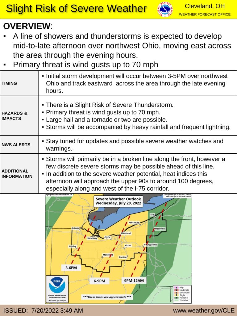
There is a slight risk of severe thunderstorms in Wood County today.
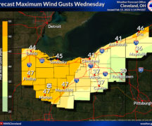
A line of thundershowers will likely move through Wood County around 3-5 p.m. today. Storms could produce wind gusts up to 70 mph and hail up to 1” diameter and around 0.5” of rainfall. Frequent lightning and heavy rainfall could occur with the storm. Tornadoes are also possible. The potential strong wind gusts are currently the primary threat of concern. It would be a good idea to secure any loose outdoor items prior to the onset of this storm.
Keep in mind that the timing of this storm will be during the afternoon/evening commute. We encourage everyone to monitor local weather conditions prior to traveling and have a plan of what to do should severe weather occur while on the road.
If you have not done so, consider registering with our CodeRED Mass Notification System by visiting https://public.coderedweb.com/CNE/en-US/BFAB7B074BCD . CodeRED is free and provides alerts specific to you and your location to keep you well informed. The National Weather Service issues these severe weather warnings and CodeRED will only alert you if you are registered in the projected area of impact. As always, outdoor warning sirens are meant to be heard outdoors not inside buildings. NOAA weather radios, radio, TV and local media weather apps are also good ways to ensure you are notified.
In addition to the evening severe weather threat, the heat index during the afternoon will approach upper 90s to near 100° along and west of I-75.