Jeff Klein, Emergency Management Agency director for Wood County, has issued the following advisory:
Possible severe weather will be in our forecast through this Thursday. (FYI—NWS Cleveland usually only goes three days out for what they consider a valid forecast so let’s hope for good things Friday)
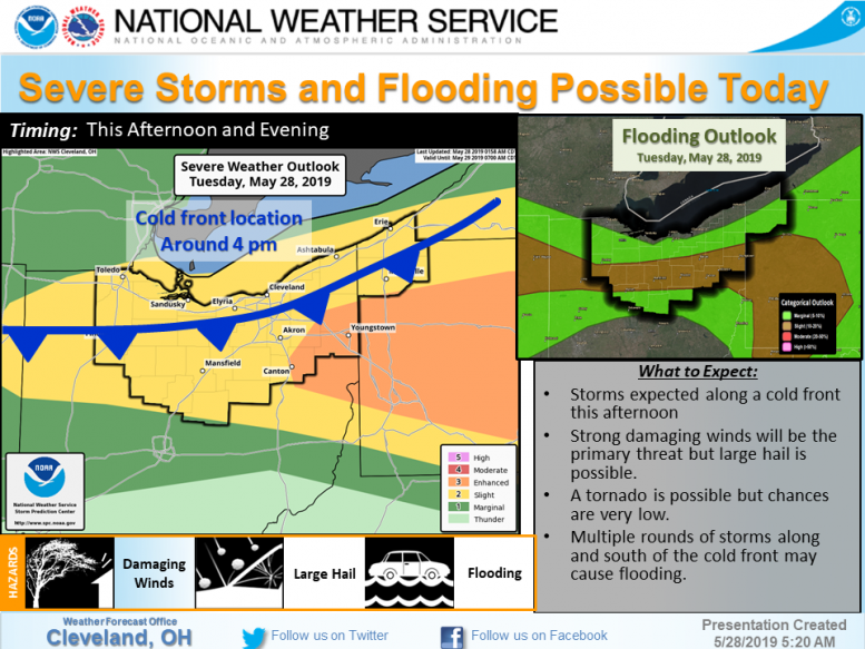
TUESDAY
NWS Cleveland is expecting a cold front to move in this afternoon around 4 p.m. Currently Wood County is in the “Slight Risk” for severe weather. Strong winds will be the primary threat, but large hail is possible with a low chance of a tornado.
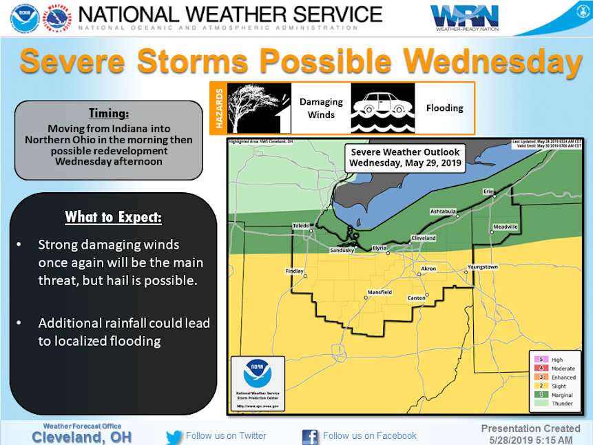
WEDNESDAY
Storms may be moving into NW Ohio from Indiana in the morning with additional development possible in the afternoon. Strong damaging winds will be the main concern but hail will be possible. Localizedheavy rainfall may cause flooding.
THURSDAY
A stronger cold front will cross the area on Thursday with another round of strong to severe thunderstorms possible.
We will be providing updates as they become available. As always, please contact the EMA should your community receive any storm damage.