The Wood County Emergency Management Agency has issued the following advisory:
Wood County is expecting two rounds of potentially severe weather in the next 48 hours.
The first round will arrive late tonight into early Friday morning. This event should not pose much of a threat, just general thunderstorms. But it may impact the severity of thunderstorms redeveloping Friday afternoon.
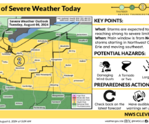
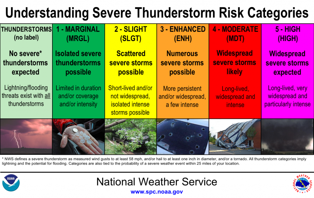
Friday afternoon we can expect the possibility of severe weather mainly between 3pm to 10pm. The majority of Wood County will be under a “Slight Risk” of severe thunderstorms, the extreme SW corner of Wood County (Fostoria area) will be in an “Enhanced Risk” of severe weather. The primary concerns Friday afternoon will be damaging winds and hail up to 1.5”. There is a risk of a tornado, but concerns are low one will occur.
Preparations:
Now is the time to secure all loose items outdoor and trim dead tree branches. Make sure eaves troughs are clear of debris, down spouts unobstructed, sewer grates are open and can drain freely. Make sure cell phones, back-up batteries are fully charged as well as any other battery powered devices you may need.
Monitor local weather conditions from National Weather Service (NWS), local and download weather apps. Remember, most weather apps look at one Tilt of the radar, NWS makes their decisions on multiple Tilts. Have multiple ways to receive weather alerts and be alert. If you have not registered for Countywide mass notification system CodeRED, here is the linkhttps://public.coderedweb.com/CNE/en-US/BFAB7B074BCD
Plan your day to avoid working outdoors or traveling during the weather threat. If you must have a plan of what you will do if severe weather occurs.