The Wood County Emergency Management Agency has issued the following advisory:
The western portion of Wood County has the potential for severe weather Wednesday afternoon. Because the Wednesday weather forecast is 48-hours or so out, this forecast is subject to change.
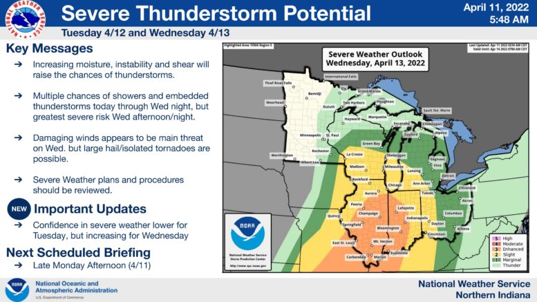
The information attached is from our partners at NWS North Webster (Ft Wayne) Indiana. Their confidence for this potential severe weather event is continuing to increase. The expected time frame for severe weather is set to begin late Wednesday afternoon and go into the evening hours. This event could potentially impact the Wednesday evening commute. Additionally, areas in the center of the storm complex have an “Enhanced” risk of severe weather. Should the system progress eastward, the potential for severe weather for Wood County could increase.
The primary concerns for this weather event will be high winds, hail, and a possible isolated tornado. As always, we recommend multiple ways to receive emergency weather alerts such as CodeRED, NOAA Weather Radios, as well as smart phone weather apps. The registration link for CodeRED is: https://public.coderedweb.com/CNE/en-US/BFAB7B074BCD .
The Wood County EMA will continue to monitor and provide updates as appropriate.